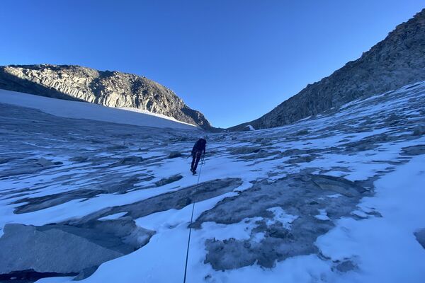
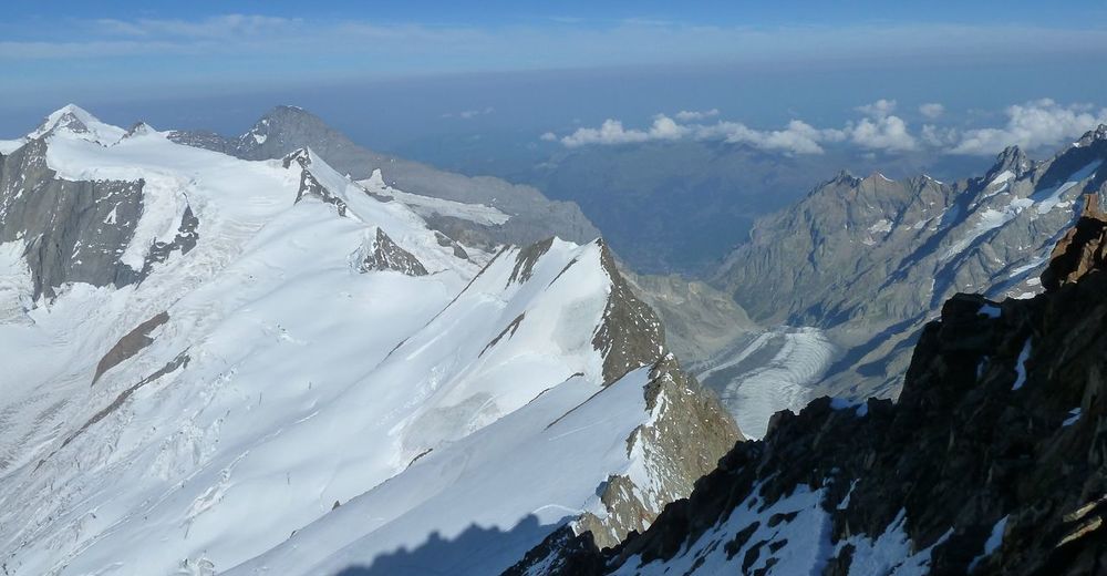
© Mammut - Team Germany 1
© Mammut - Team Germany 1

© Mammut - Team Germany 1

© Mammut - Team Germany 1

© Mammut - Team Germany 1

© Mammut - Team Germany 1

© Mammut - Team Germany 1

© Stefan Schelling
Údaje o túre
7,61km
3.041
- 4.078m
1.041hm
1.036hm
13:00h

Mammut
- Stručný popis
-
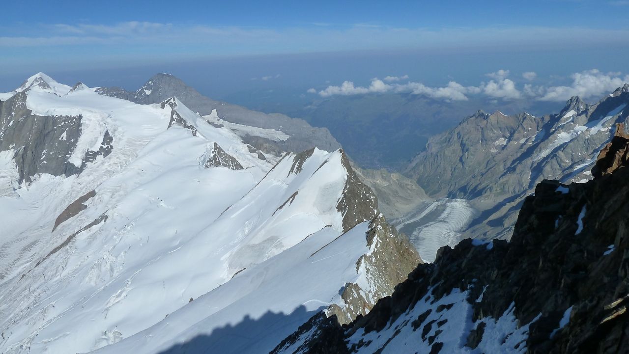
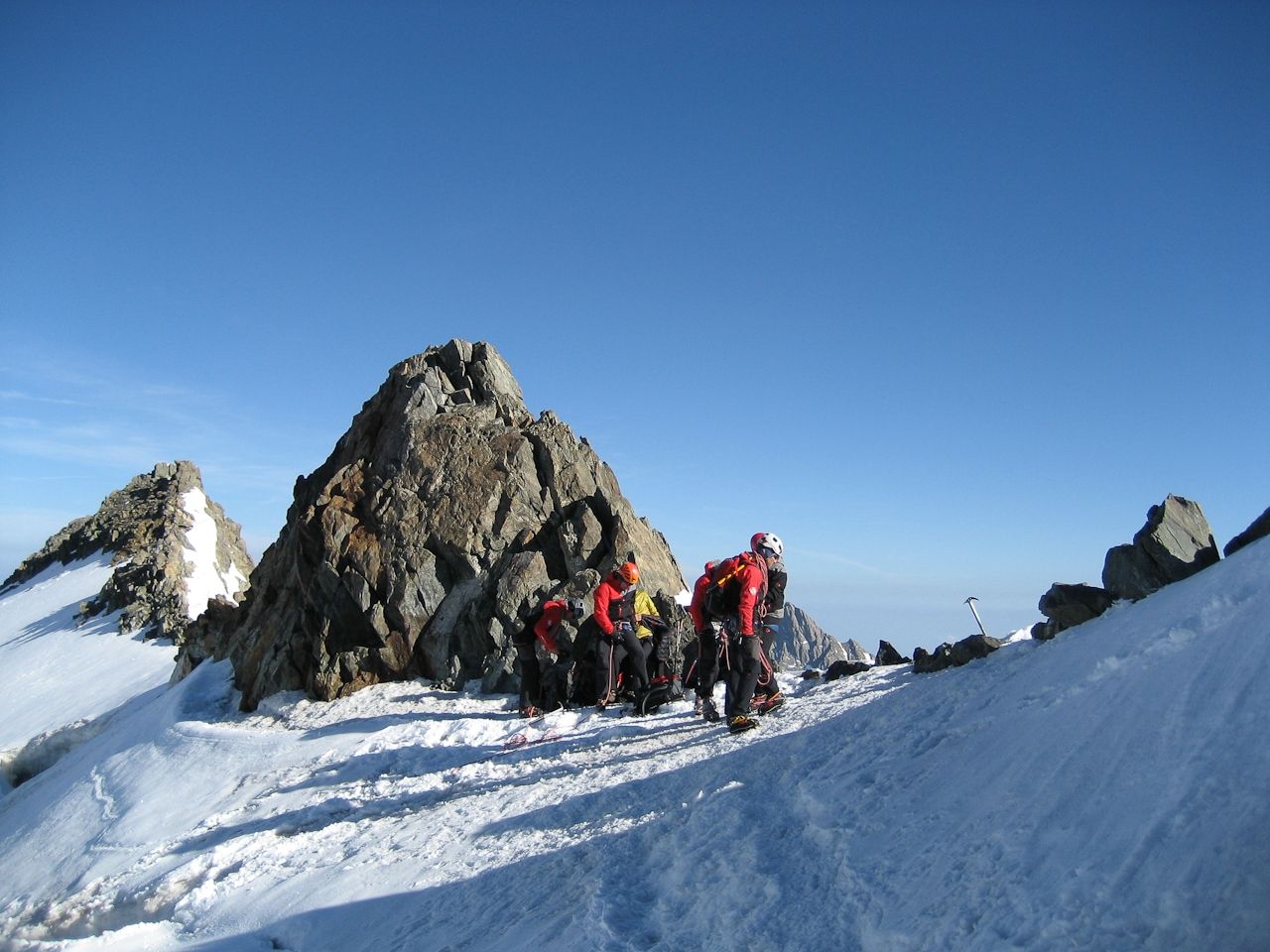
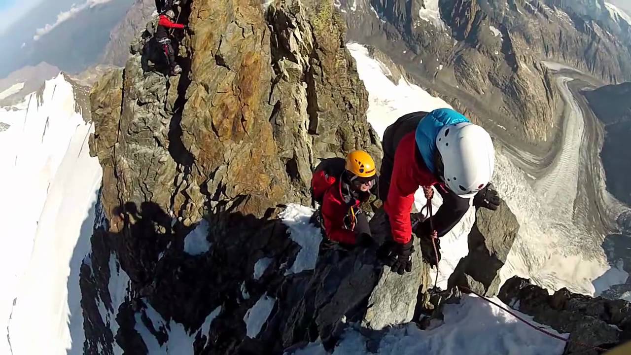
Finsteraarhorn is the highest peak of the canton Bernese Oberland and the third most prominent peak in the Alps. It has the shape of a steep, majestic pyramid, rising from a web of glaciers. And it is one of the most beautiful mountains in the entire Switzerland.
Despite its superior height, its northwestern neighbors Jungfrau (4158m), Mönch (4099m), and Eiger (3970m) are more famous, owing in part to Eiger's towering north face, in part to the tourism that has built up around them.
- Obtiažnosť
-
stredná
- Hodnotenie
-
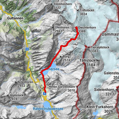
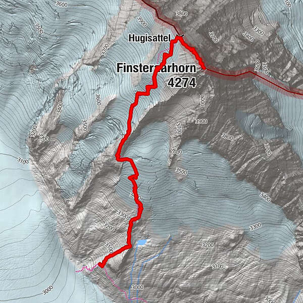
- Trasa
-
Hugisattel3,3 kmFinsteraarhorn (4.274 m)3,8 km
- Najlepšia sezóna (ročné obdobie)
-
janfebmaraprmájjúnjúlaugsepoktnovdec
- Najvyšší bod
- 4.078 m
- Cieľová destinácia
-
Finsteraarhorn
- Profil nadmorskej výšky
-
 © outdooractive.com


-

-
AutorMammutPrehliadka Finsteraarhorn 4.274m (normal route) používa outdooractive.com na stránke ..
GPS Downloads


Všeobecné informácie
S výhľadmi
Ďalšie prehliadky v regiónoch
-
Aletsch Arena
38
-
Jungfrau Region
23