

© Tatzreiter

© Fischbach

© Fischbach
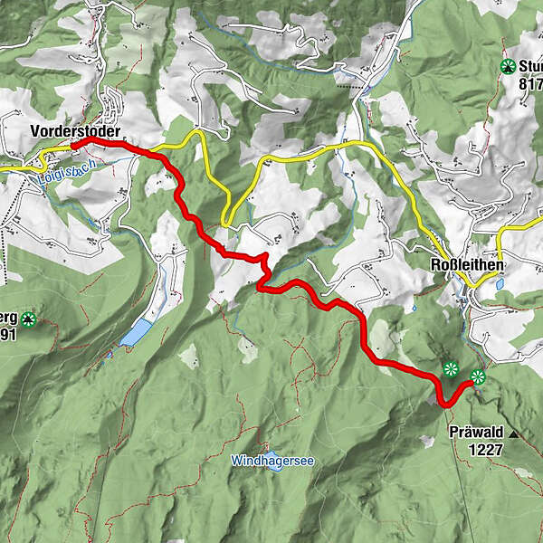
Údaje o túre
11,5km
758
- 885m
299hm
02:30h
- Stručný popis
-
Schwierigkeitsgrad: blau
- Hodnotenie
-
- Východisko
-
Gemeindeamt Vorderstoder
www.pyhrn-priel.net/de/sommer/2691847... - Trasa
-
Vorderstoder0,0 km
- Najvyšší bod
- 885 m
- Zvyšok/Ústup
-
Dorfstüberl, Stockerwirt, Bergpfeffer
- Mapy
-
Wanderkarte Pyhrn-Priel erhätlich in allen Pyhrn-Priel Tourismusbüros!
GPS Downloads


Podmienky na trase
Asfalt
Štrk
Lúka
Les
Skala
Exponovaný
Ďalšie prehliadky v regiónoch
-
Traunviertel
1940
-
Urlaubsregion Pyhrn - Priel
1440
-
Vorderstoder
438


")


