© Unbekannt - Kandersteg Tourismus

© Kandersteg Tourismus


- Stručný popis
-
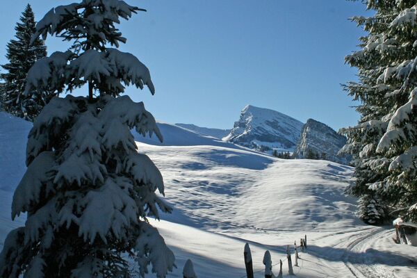
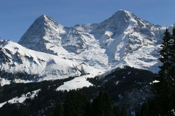
This circular tour begins along the river Kander heading north. Now the route climbs into Höhwald. After you have made the 140-metre ascent, we suggest a short detour to the viewing point “Ristenegg”. The view over the village of Kandersteg and the Blüemlisalp mountain range is magnificent. Then, it’s time for the descent in the direction of “Bütschels”. This part of the hike again continues through parts of Höhwald and especially beautiful forest glades. You reach the viewing point again along the river Kander.
- Obtiažnosť
-
stredná
- Hodnotenie
-
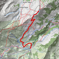
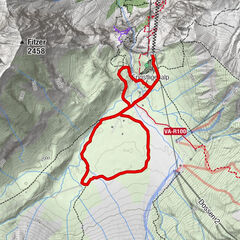
- Trasa
-
Kandersteg (1.176 m)0,0 kmKandersteg (1.174 m)0,4 kmKandersteg (1.176 m)5,8 km
- Najlepšia sezóna (ročné obdobie)
-
augsepoktnovdecjanfebmaraprmájjúnjúl
- Najvyšší bod
- 1.308 m
- Cieľová destinácia
-
Kandersteg, Bahnhofplatz (1170 m)
- Profil nadmorskej výšky
-
 © outdooractive.com


-

-
AutorPrehliadka Höh Tour winter hiking trail (Kandersteg) používa outdooractive.com na stránke ..
GPS Downloads


Všeobecné informácie
S výhľadmi
Ďalšie prehliadky v regiónoch